Severus' scientific significance
Several years ago, I wrote a blogpost about discovering Severus Hill.
 |
| "Severus Hills, near York, as they appear at, about, a miles distance from the north-west angle of the City walls" by J. Haynes, 1736. (Image: York Museums Trust) |
At a recent meeting of the Friends of Severus Hill, discussing the hill being offered up for auction, I was asked to speak briefly about its Ice Age origins and geological significance. I thought it might be useful if I summarized my key points here:
Historic landscape
The hills of Holgate and Acomb are a wonderful/terrible example of York's Hidden History. Wonderful because they have such a rich and fascinating history, and terrible because so few people know about them. Severus Hill may well be the burntplace of a Roman emperor, the first to die in Britain, which is a pretty impressive starting point. However, although the 18th Century picture (above) describes the hills as "these venerable monuments of Roman grandeur" they are natural phenomena, formed thousands of years before the Roman 9th Legion appeared in northern England.
"Exhausted, ill and ready to die, Severus returned to York and ordered himself a cremation urn."
Ice Age origins
If you'd been standing in not-yet-York (Pre-boracum?) 20,000 years ago, you'd have been under tens of metres of ice. A great glacial lobe was moving slowly down the Vale of York, fed by ice streams from the A66. My friend Rodge is one of the co-authors of this recent study, so I defer to him for full details. Nonetheless, around 15,000 years ago, as the Vale of York ice lobe had begun to melt, and retreat, it deposited ridges of sediment (clay, sand, gravel, cobbles, boulders) across the Vale of York. These are known officially as terminal moraines, and the photo below shows some lovely examples from Alaska.
 |
| Terminal moraines of the Kennicott Glacier, Alaska. (Photograph copyright (C) Richard Droker, Flickr) |
Although rather older, more eroded, and built over, the landscape of York is comparable to that seen in the photo: a long and lumpy line of low hills and ridges, slightly elevated above a marshy vale. Without the terminal moraine of an ancient glacier, Eboracum wouldn't be here. And at 35 metres above sea-level, Severus Hill is one of the most prominent remains of the moraine. A perfect spot for an imperial cremation.
In the geological map below, made by Bill Fairburn during his PhD research at the University of Sheffield, the glacial landscape of York - including Severus Hill (marked as Severs Howe) - is shown in detail:
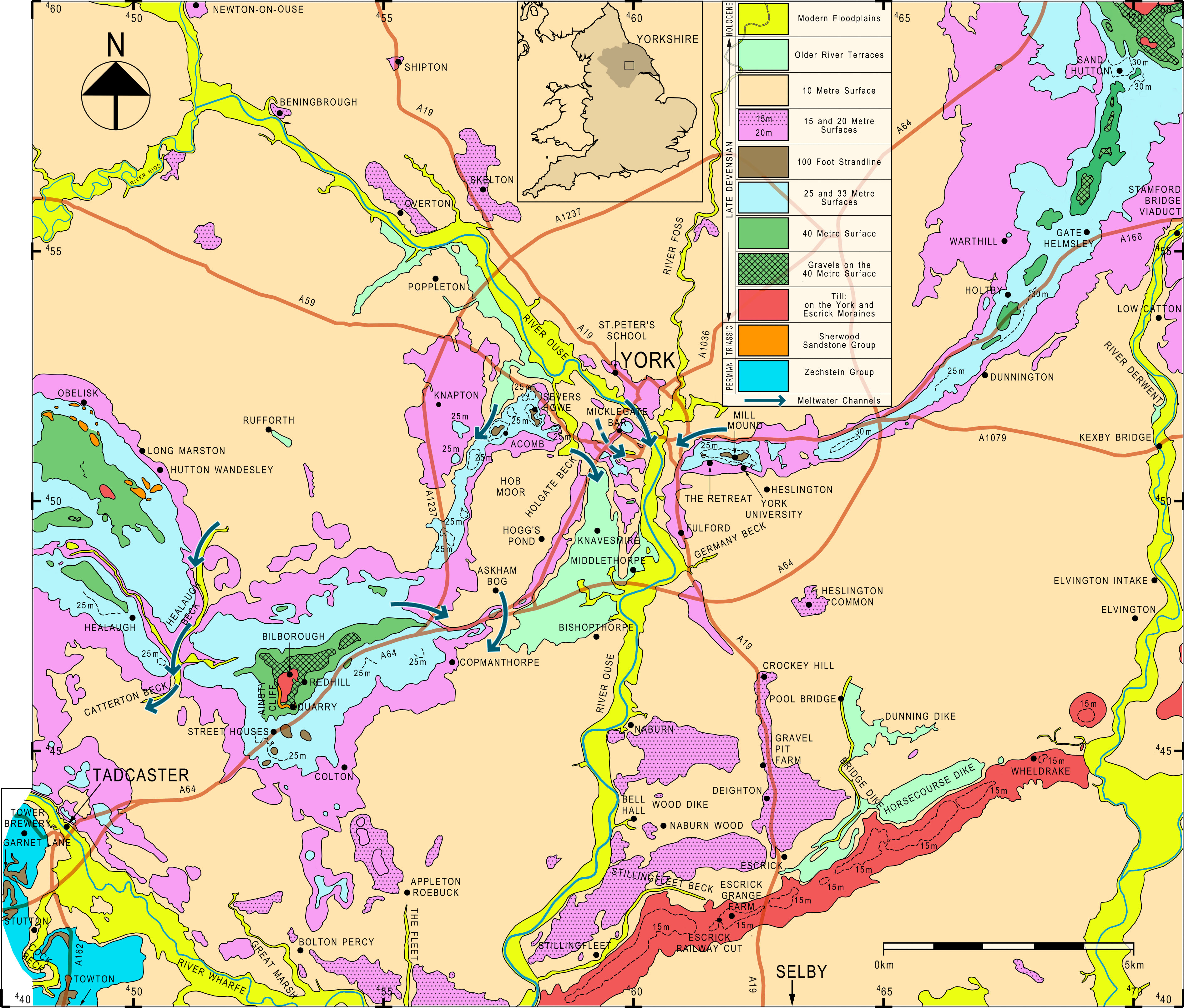 |
| The glacial geology of York (C) Bill Fairburn, 2014. |
In his 2009 paper in the Proceedings of the Yorkshire Geological Society, Bill mentions Severs Howe several times. He states that till is exposed at grid reference SE 580 518 (off Bouthwaite Drive), along with a strand-line of an ancient lake, whilst glacial river deposits can be seen at SE 583 521
(near Poppleton Road Memorial Hall). The strand-line is particularly
interesting, as it would indicate that Severus Hill was an island in a
lake for some of its early life. That would have been an even more dramatic setting for a Severan pyre!
Geodiversity
Severus Hill is a great place to discuss geodiversity. People are increasingly aware of biodiversity - the variety of life - and its importance to the planet. Far fewer realise that biodiversity is strongly dependent on the variety of rocks, minerals, soils, and landscapes that underpin it.
When looking at a geological map* of Acomb and Holgate (below), we can get a sense of this. In a small area of western suburban York, there are river deposits, lake deposits, glacial deposits, creating a patchwork of clays, silts, sands, and gravels.
 |
| An annotated geological map of Acomb and Holgate, York. 1 = Acomb Primary School; 2 = Acomb Green; 3 = Holgate Windmill; 4 = Moses Cotsworth's House; 5 = Acomb Police Station; 6 = Fishponds Wood. (Reproduced with the permission of the British Geological Survey © UKRI 2023. All Rights Reserved.) |
Severus Hill also provides a great example of people inadvertently creating
geodiversity, which then enhances biodiversity. The 2010 City of York Biodiversity Audit designated the former Severus
Reservoir - marked on the map above with red hatched lines and the letters MGR-ARTDP - as a SINC (Site
of Importance to Nature Conservation), due to its calcicolous grassland habitat. This was described in the report (p. 27) as 'the most uncommon grassland type within York' and the lime-loving plants almost certainly shouldn't be there. The York Moraine is not normally very limy. It is highly likely that 'human activity...created base rich soils and substrates which have then been naturally colonised' (p. 27).
Earth Quaker
Talking of people, human activity doesn't have to be inadvertently geological. In the case of one Holgate resident, his interest in Severus Hill was decidedly geological.
I'd not heard of Moses Bruines Cotsworth until last year, when I stumbled upon him in Adam Hart-Davis' Local Heroes book. I then read Anna Cook's biography of Cotsworth on the Yorkshire Philosophical Society website, and upon finishing it, exclaimed "Why doesn't EVERYONE know about the remarkable life of this man?"
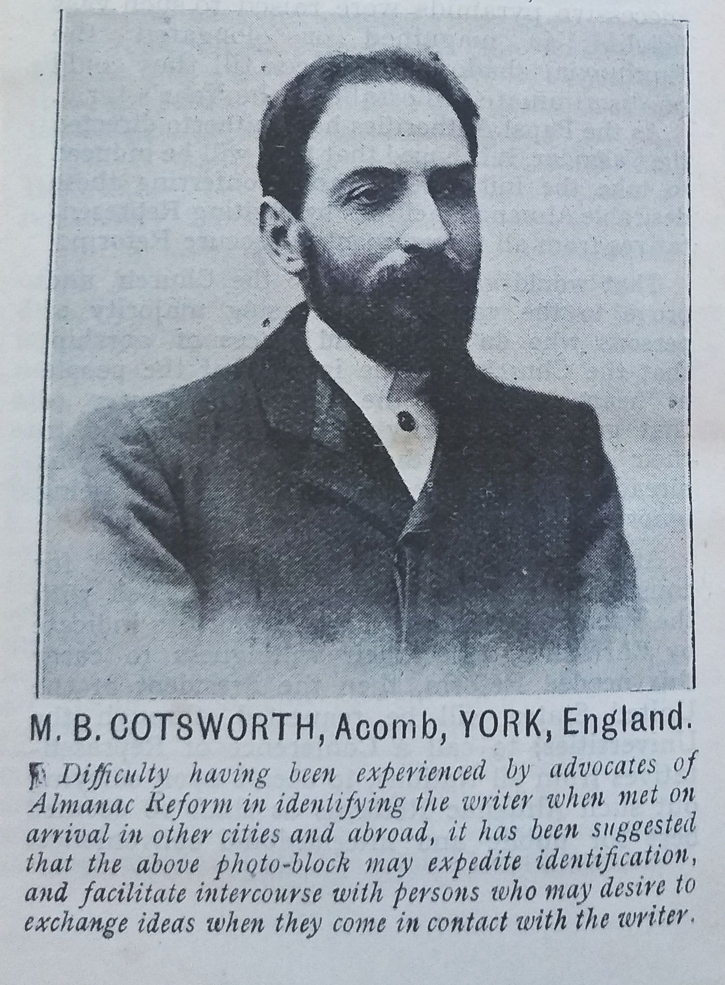 |
| M. B. Cotsworth, Acomb, YORK, England. (Image from oddbooks.co.uk) |
As a geologist I was particularly startled to discover that, in his Rational Almanac of 1904, Cotsworth had come up with a theory that, driven by the expansion and contraction of glaciers, continents might be able to move across the Earth's surface. This was eight years before Alfred Wegener famously proposed his idea of continental drift, and - unlike Wegener - Cotsworth had an explanatory mechanism. It would be decades before plate tectonics came on to the scene.
What does this have to do with Severus Hill? Well, Cotsworth lived on Acomb Road, close to the junction with New Lane (location 4 on the annotated map), and spent a lot of time exploring the local area. In his Rational Almanac, he describes meeting with the American geologist Professor G. F. Wright in York. They were looking for evidence of glacial processes, and Cotsworth wrote that "behind our house...[Wright] pointed out the fact that Severus Hills, etc., within York, were formed by Glacial Moraines" (p. 222).
So, if the landscape, glacial history and geodiversity of Severus Hill wasn't enough, it also has a (little-known) value to the history of Earth science. It's a no-brainer to say it should be saved, but we've only got a few months to make it happen.
 |
| Severus Hill in the 1920s. What will it be like in a century's time? (Image: copyright Explore York image archive) |
Oh, and if you're interested in learning more about the geography of York, I'm leading an afternoon class on Saturday January 27th 2024, via the Centre for Lifelong Learning. Severus Hill will feature prominently!
*A geological map is always wrong, though, especially in urban areas,
where so little natural material is actually visible. There
is clearly a citizen science project opportunity, where we ask everyone
who lives in the area to dig into their gardens and report their geological findings.
Comments